Beautiful Easy Hikes Near Burlington, Vermont
Note: Advertising is how we keep this site free for you to enjoy, and we earn a commission from affiliate links that may be included in this post. Thank you for supporting Vermont Explored!
Vermont’s only metropolis has been named one of the healthiest cities in the US many times over the years, perhaps because it takes its outdoor recreation so seriously.
Table of Contents
The city of Burlington, Vermont, is home to numerous parks, trails, gardens, and natural areas, and the surrounding areas offer plenty of additional opportunities to get outside.
If you’re planning a visit to this beautiful part of Vermont, you’ll be happy to know that there are lots of easy hikes near Burlington to take advantage of.
Whether you’re hiking with your family or just want to get away from the bustle of town for a bit, chances are there’s a hiking trail near Burlington with your name on it.
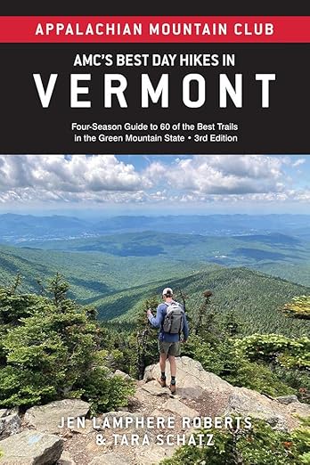
Featured Read: AMC’s Best Day Hikes in Vermont
Written by Tara Schatz and Jen Lamphere Roberts, this fully revised guide includes classic hikes such as Camel’s Hump, Mount Mansfield, and sections of the Long and Appalachian trails, along with new additions Raven Ridge, Killington Peak, Moose Bog, and more.
Whether you’re looking for an exploration of nature or to bag a 4,000-footer, AMC’s Best Day Hikes in Vermont is indispensable.
Easy Hiking Trails Near Burlington, Vermont: Map
Here’s a map of our favorite easy hiking trails in and around Burlington. Simply click the expansion box in the upper-right corner to open the map in a new tab.
Our Favorite Easy Hikes in Burlington, Vermont
Vermont’s largest city wholeheartedly embraces the outdoors.
There are dozens of parks, several paved bike trails, and numerous places to swim in Lake Champlain, and while we aren’t including many mountain hikes in this post, there are enough easy trails to keep you blissfully wandering for many happy days.
There are so many beautiful hiking trails near Burlington, but these are our favorites. All of these hikes are within 30 minutes of Burlington and easy enough for outdoor-loving kids.
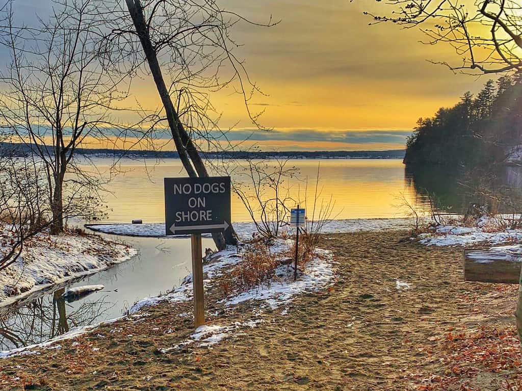
Red Rocks Park, South Burlington, Vermont: The Best Hiking in Burlington
Distance: 1-3 miles, round-trip | Difficulty: Easy | Dogs: on-leash| Cost: $5 residents, $8 non-residents| | Trail Guide
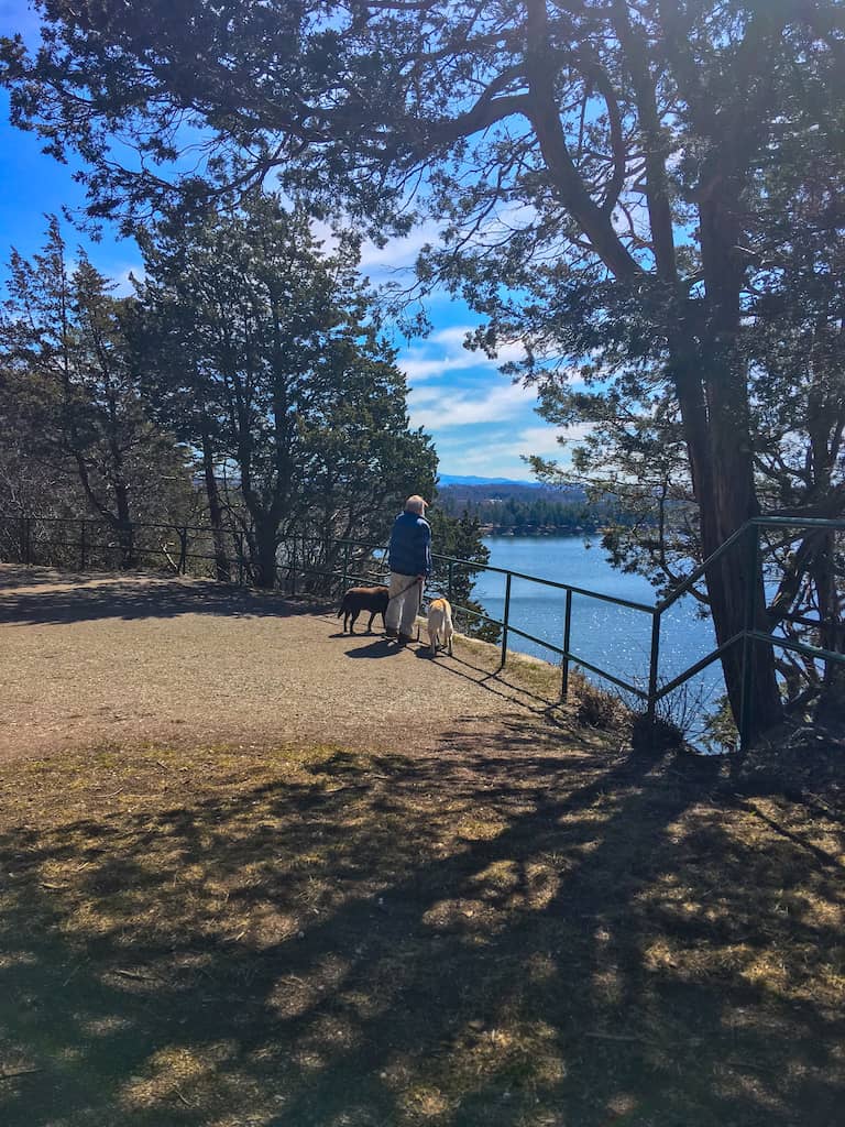

When I was a kid, Red Rocks was where the bad boys jumped off cliffs into Lake Champlain.
I’m sure that’s still going on, but for me, the real treasure of Red Rocks is the Lake Trail, which meanders along many of the aforementioned cliffs, providing unparalleled views of the Adirondacks and Lake Champlain.
The paths at Red Rocks Park are mostly hard-packed gravel, and there are barriers between the trail and the cliff edges for safety. This is an easy walk that will take you about an hour, depending on how motivated you are.
If you want to do a little more exploring beyond the Lake Trail, my kiddos recommend a climb on the Lichen Ledges and a swim at the public beach before calling it a day. The trail guide above links to a 2.7-mile loop throughout the park, but this is a choose-your-own-adventure kind of park, so you can tailor the distance to whatever you’re feeling when you set out.
Read Next: The Best Things to Do in Burlington, Vermont this Summer
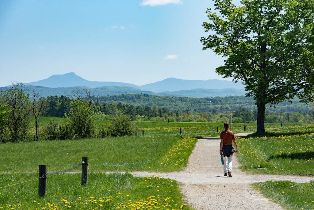
Mt. Philo State Park, Charlotte: Welcome to Vermont’s First State Park
Distance: 1.8 miles, round trip | Difficulty: Short and steep | Dogs: on-leash| Cost: $5 adults, $2 kids | Trail Guide
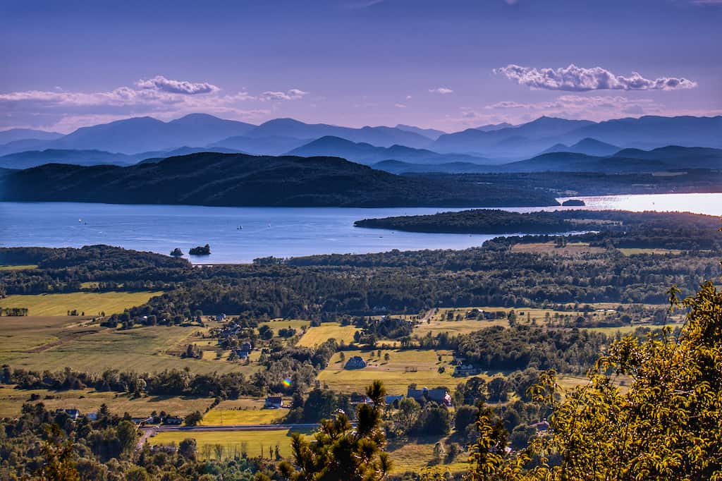
Mount Philo is definitely one of our all-time favorite places to watch the sunset over Lake Champlain.
I wrote a bit about Mount Philo in this post about exploring the Lake Champlain Valley. I have to be honest, though, we usually drive up to the top of the mountain, mainly because we’re carting along the perfect sunset picnic.
I’m including Mt. Philo on this Vermont hiking list, though, because it was my absolute favorite hike to take with my grandparents when I was a kid.
The trail from the parking lot to the summit is ¾ of a mile. It’s an uphill climb the whole way, and the whole world opens up when you get to the top.
I think I loved this hike so much as a kid because it really felt like I had accomplished something when I got to the top.
Additional information: During the open season (Memorial Day to Indigenous Peoples’ Day), restrooms are located at the top. There’s also a charmingly quiet campground with fewer than a dozen sites. I love camping here and waking up in time for the sunrise. For a campground/trail map, visit Vermont State Parks.
Colchester Bog, Airport Park, Colchester: A Perfect Stop on Your Colchester Bike Ride
Distance: .2 miles, round trip | Difficulty: Easy | Dogs: on-leash| Cost: Free | Trail Guide
Airport Park in Colchester is a good starting point for all kinds of outdoor adventures.
Jogging paths, recreation fields, playground equipment, and restrooms make this a favorite after-school park year-round. You can also access the Colchester Causeway for a nice flat bike ride along Lake Champlain.
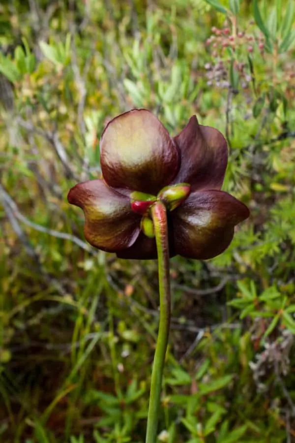
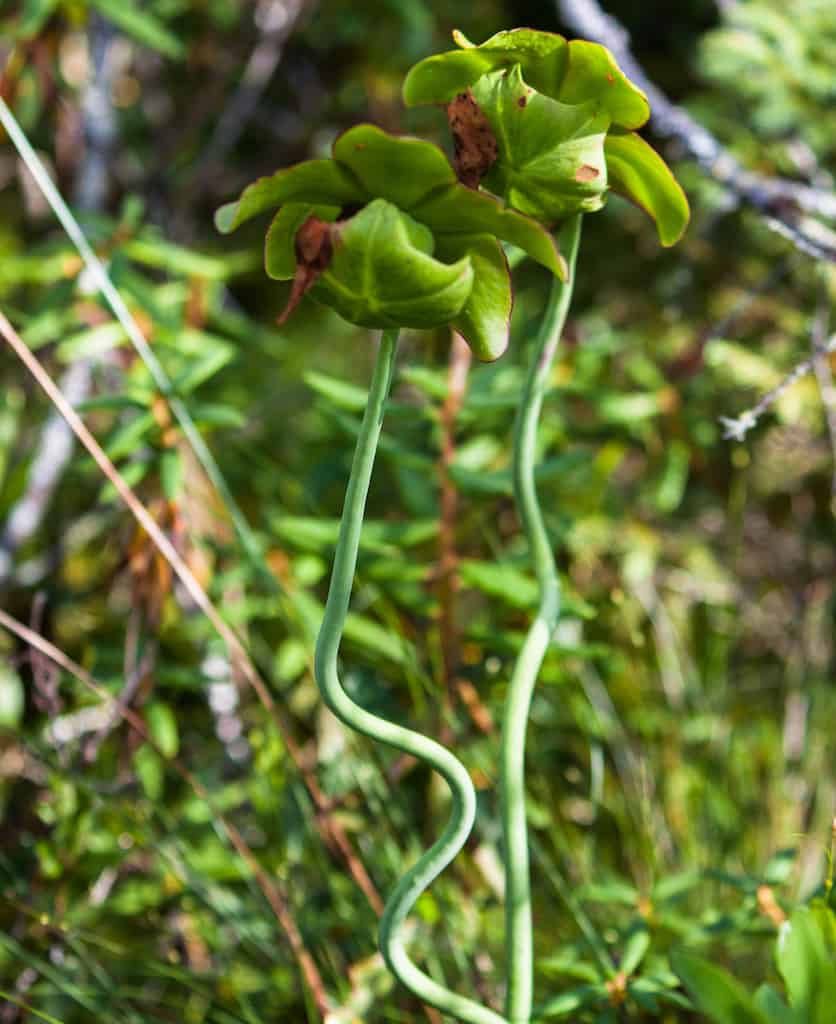
Our favorite discovery within Airport Park is Colchester Bog, where you’ll find some of the coolest plants in all of Vermont. A boardwalk delves deep into the bog, making it easy for kids to get up close and personal with this unique ecosystem.
You’ll find swampy forests here, as well as some open peat bogs, and dense thickets of shrubs. Please stay on the boardwalk to protect this fragile community.
Niquette Bay State Park, Colchester: Hike Along Lake Champlain with Mountain Views
Distance: varies | Difficulty: varies | Dogs: on-leash| Cost: $5 adults, $2 kids | Trail Guide
I first fell in love with Niquette Bay State Park because the trails are so dog-friendly.
Unfortunately, dogs are no longer permitted to wander around off-leash when the park is open (May 6th to Indigenous Peoples’ Day). You’ll still find plenty of happy dogs in the park, though, and dogs can still swim at Calm Cove.
There are all kinds of trails at Niquette Bay State Park, ranging in length and difficulty, so whether you want to spend an hour or an afternoon, you’ll find a trail that’s perfect for your adventure.
My favorite trail at Niquette Bay is the Muhley Trail to the Island View Trail (views!!), back to the Muhley Trail to Calm Cove for a swim, and back to the parking lot via Burns Trail (easier) or Ledges Trail (more difficult).
Families with young kids can take Allen Trail straight to the beach, and the trail mentioned above is great for older kids who need to burn off some energy.
For more information, including directions, check out Vermont State Parks.
Shelburne Farms, Shelburne: Easy Hike Near Burlington with Stunning Views
Distance: varies | Difficulty: mostly easy | Dogs: no| Cost: donations are appreciated | Trail Guide
The 10 miles of walking trails at Shelburne Farms are perfect for meandering among fields, through forests, and along the shores of Lake Champlain. It’s a favorite spot for tourists, joggers, and walkers, and is one of the best easy hikes near Burlington.
Park at the welcome center and take the trail on the left toward Lake Champlain. Pass the farm barn and take the Farm Trail past Lone Tree Hill, the farm’s highest point.
There is a bench here to relax on and take in the stunning views of Lake Champlain and the Adirondack Mountains.
From Lone Tree Hill, continue on the Farm Trail to the lake, take the Buckthorn Tunnel Trail just for fun, and loop back toward the welcome center on the North Gate Pass.
The loop is just under four miles, but there are side paths you can take if you want a longer walk. There are even formal gardens to explore near the historic inn.
Additional information: Shelburne Farms is a nonprofit organization and working farm with a robust calendar of events for families. The Inn at Shelburne Farms is a great place to stay while exploring the Burlington area.
Ethan Allen Homestead, Burlington: Hiking and Cross-Country Skiing
Distance: varies | Difficulty: easy | Dogs: on-leash| Cost: free | Trail Guide
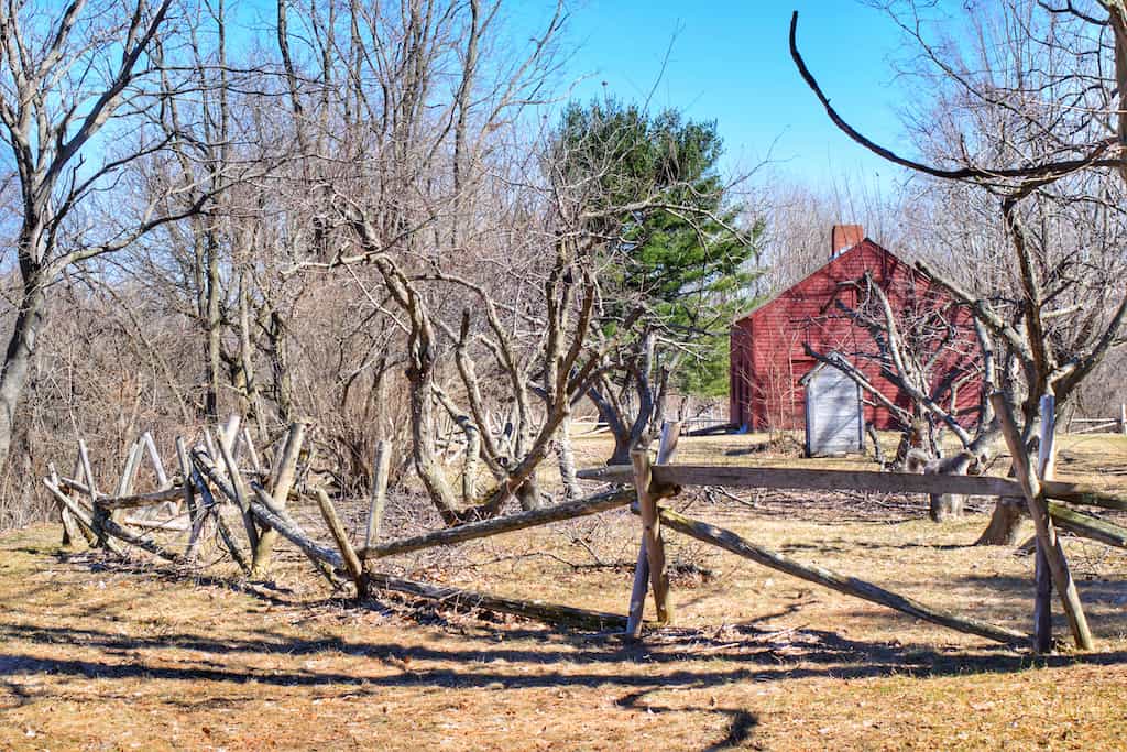
The Ethan Allen Homestead in Burlington is a fabulous community resource.
The sprawling grounds include four miles of hiking, biking, and cross-country ski trails, the restored farmhouse of Ethan and Fanny Allen (built in 1787), and the Ethan Allen Homestead Museum.
Bike paths connect the Ethan Allen Homestead with nearby Ethan Allen Park to the north and the Intervale to the south.
Begin your hike at the Ethan Allen Homestead Museum and take the Homestead Loop, to the Pond Trail, to the Peninsula Loop for an easy hike under three miles.
Much of this hike runs along the Winooski River, with opportunities to spot wildlife, including raccoons, otters, beavers, and deer. There are boardwalks through the wetlands, but this is still a wet walk year-round.
Ethan Allen Homestead Park is managed by the Winooski Valley Park District. Need a trail map? Here ya go!
The Intervale, Burlington: More Burlington Hiking Trails along the Winooski River
Distance: varies | Difficulty: easy | Dogs: on-leash| Cost: free | Trail Guide
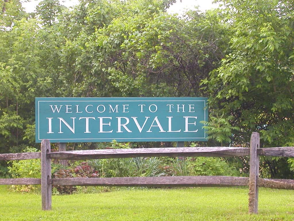
The recreational trails at the Intervale are perfect for biking, birding, walking, jogging, and winter skiing on groomed trails.
The trails wind along the Winooski River to Ethan Allen Homestead (mentioned above). The Intervale is on a low floodplain, so expect muddy conditions on flat trails.
Drive down Intervale Road and park in one of the many parking areas. We like to park in the lot across from Gardner’s Supply so we can browse for plants after our walk.
Take Calkins Trail for 1.3 miles along the river, and then retrace your steps or walk back to your car on Farm Road past many of the community farms that are part of the Intervale Center.
The Intervale is open 365 days a year and is free to the public.
The Intervale Center manages 360 acres of farmland, trails, and open space, with a mission to strengthen community food systems by enhancing farm viability, promoting the sustainable use of agricultural lands, and engaging people in the food system.
Here’s a trail map to help plan your adventure.
Read Next: Easy Hikes in Southern Vermont
Ethan Allen Park, Burlington: Stunning views of the Adirondacks
Distance: 4.2 miles of trails | Difficulty: easy | Dogs: on-leash | Cost: free | Trail Guide
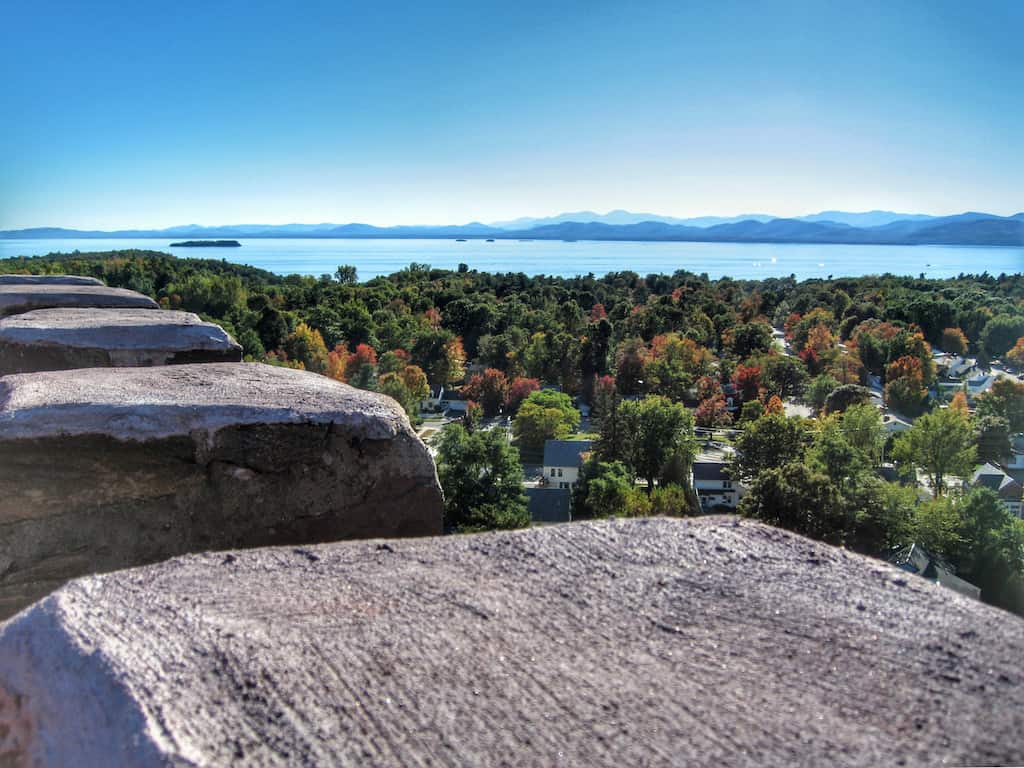
Heading in the other direction, northwest of Ethan Allen Homestead, is Ethan Allen Park, one of the first urban forest parks in the United States.
This is a 60-acre woodland park in Burlington that surrounds the city’s highest point, which is topped by a 40-foot stone tower that gives visitors a 360-degree view of Burlington, Lake Champlain, the Adirondacks, and the Green Mountains.
There are four miles of easy trails in Burlington’s Ethan Allen Park, both paved and dirt. In addition to the trail network, there is a playground, a picnic area, and a gazebo. The park is connected to Ethan Allen Homestead via the 127 Bike Path.
Ethan Allen Park is maintained by Burlington Parks, Recreation, and Waterfront. Here’s a trail map to help you plan.
Colchester Pond, Colchester: Great for Paddling, Too!
Distance: 3.2-mile loop | Difficulty: mostly easy | Dogs: on-leash | Cost: Free | Trail Guide
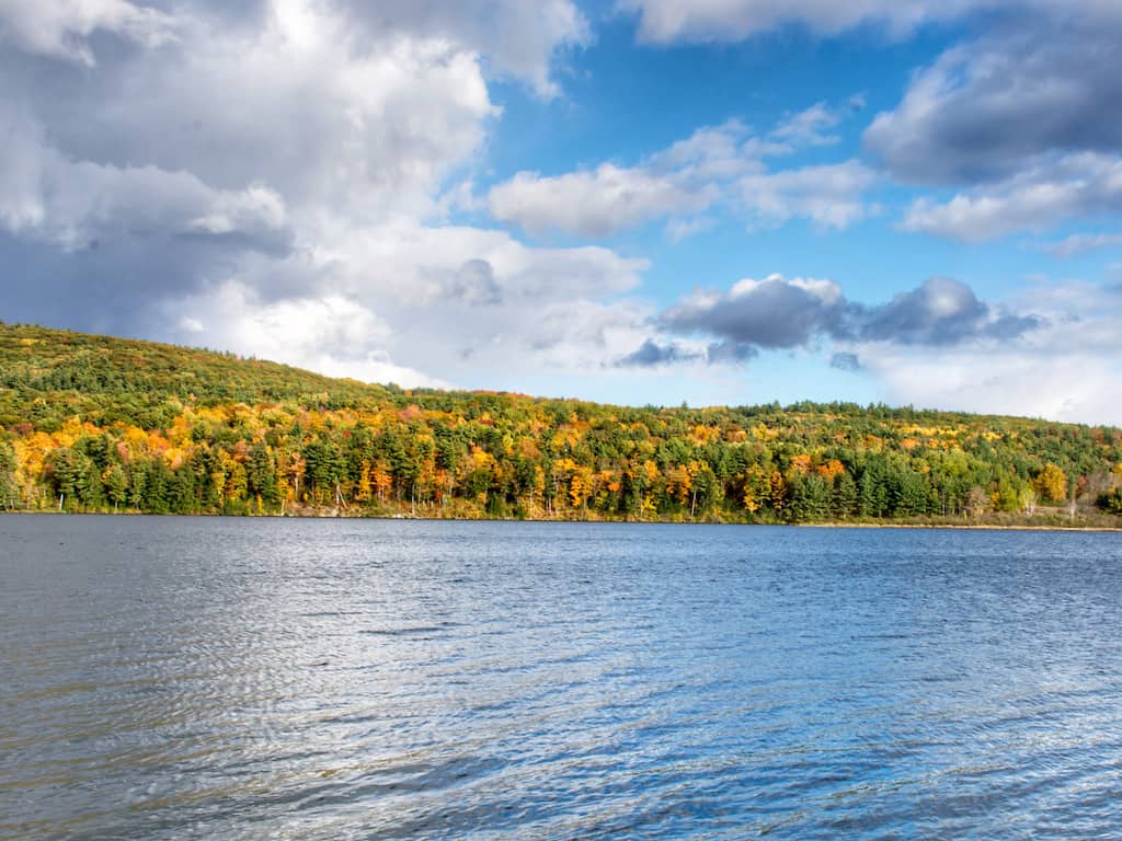
While the Colchester Pond loop is a busy and well-traveled trail, it is still one of the best Burlington hikes for escaping the city and finding peaceful solitude.
The trail travels along the edge of the pond, through meadows and woodland, and gains about 300 feet in elevation along the high banks on the far side.
The trail is muddy in spots, with lots of rocks and roots to watch out for, as well as wildflowers, mushrooms, and critters. There are several scenic views along the way, as well as great picnic spots.
Colchester Pond is maintained by the Winooski Valley Park District. Here’s a trail map via Trail Finder.
Rock Point: A Wild Corner of Burlington
Distance: varies | Difficulty: mostly easy | Dogs: on-leash | Cost: Free permit available online | Trail Guide
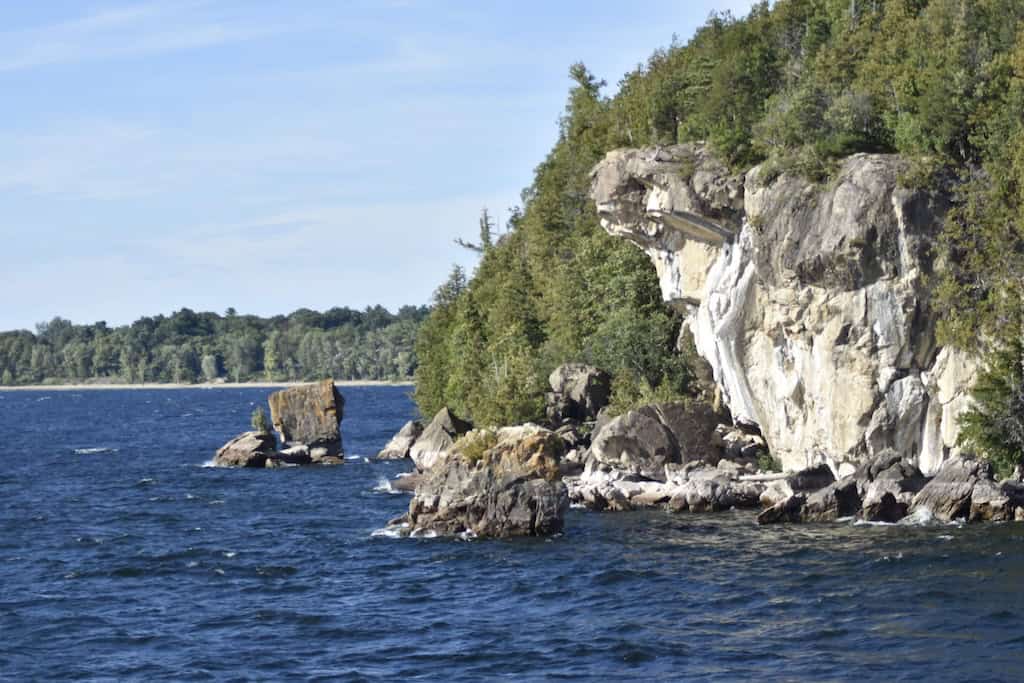
Tucked along the shores of Lake Champlain on 130 acres of conserved land, Rock Point feels worlds away from Church Street.
It’s one of the most significant rare plant sites in the entire state, with upland wetland and cliff habitats, and one of the most visible exposures of a dolomite thrust fault in North America.
The trails are free and open to the public, but you’ll want to grab a trail pass before you arrive.
Groups of more than 10 should reach out to Rock Point Commons in advance. The land is privately owned and conserved through a partnership with the Lake Champlain Land Trust and the City of Burlington, so visiting here comes with a responsibility to treat it well.
Voluntary donations go directly toward conservation efforts and Rock Point’s broader mission of education and environmental stewardship.
I recommend the 1.7-mile Rock Point loop. You’ll get beautiful lake views, varied terrain, and well-maintained trails throughout. A few caveats: expect some muddy spots and a couple of steep climbs, so wear footwear you don’t mind getting dirty.
Over two miles of trails wind through the property in total, which gives you plenty of room to explore beyond the loop if you’re feeling ambitious.
Shelburne Bay Park Loop: Lake Views and a Little Adventure
Distance: 2.5-mile loop | Difficulty: mostly easy | Dogs: on-leash| Cost: free | Trail Guide
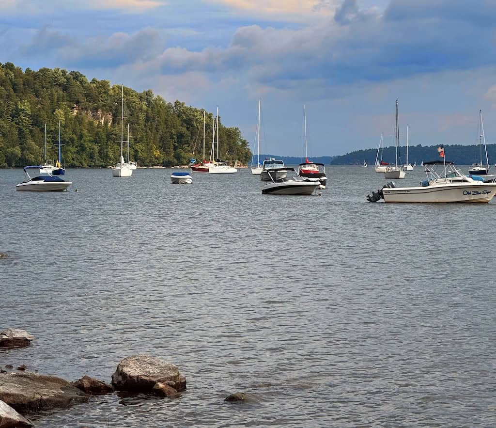
Shelburne Bay Park covers 93 acres of surprisingly diverse terrain, with over a mile of lakefrontage, forested ledges, and open meadows all packed into one spot. The trail climbs through the woods before opening up to a scenic lookout over the bay, and that payoff is worth every muddy step.
A heads up before you go: the trail markings leave something to be desired. Social paths weave through the established hiking routes, and it’s easy to second-guess yourself at a few junctions. Go slow, stay observant, and you’ll be fine, but don’t expect a perfectly signed experience.
Beyond the loop trail, the park has plenty to offer. The 1.4-mile Recreation Bike Path runs from the parking lot off Bay Road in the southeast corner through to Harbor Road in the northwest, and it connects across Bay Road to the Ti-Haul Trail, which adds another mile-plus toward Harbor Road near Davis Park.
Walkers, snowshoers, and cross-country skiers are all welcome on the Recreation Path as well.
Dogs are welcome on leashes; motorized vehicles are not allowed on trails; and it’s a pack-in, pack-out situation. Parking is available, and you’ll also find picnic areas and fishing access on site.
It’s an underrated little park, and if you time it right, those lake views are hard to beat.
Many of the hikes mentioned here can be found in AMC’s Best Day Hikes in Vermont, co-authored by Yours Truly. Released in 2023, this comprehensive guide features 60 of the best day hikes in the state.
Want even more ideas for adventures in and around Burlington? These outdoor pocket adventures from Outdoor Adventure Sampler may be just what you’re looking for.
Follow us on social media for more Vermont adventures!