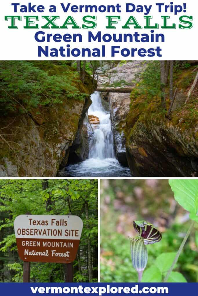
Explore Beautiful Texas Falls in Hancock, Vermont
Note: Advertising is how we keep this site free for you to enjoy, and we earn a commission from affiliate links that may be included in this post. Thank you for supporting Vermont Explored!
Ready to explore one of the most beautiful waterfalls in the Green Mountain National Forest?
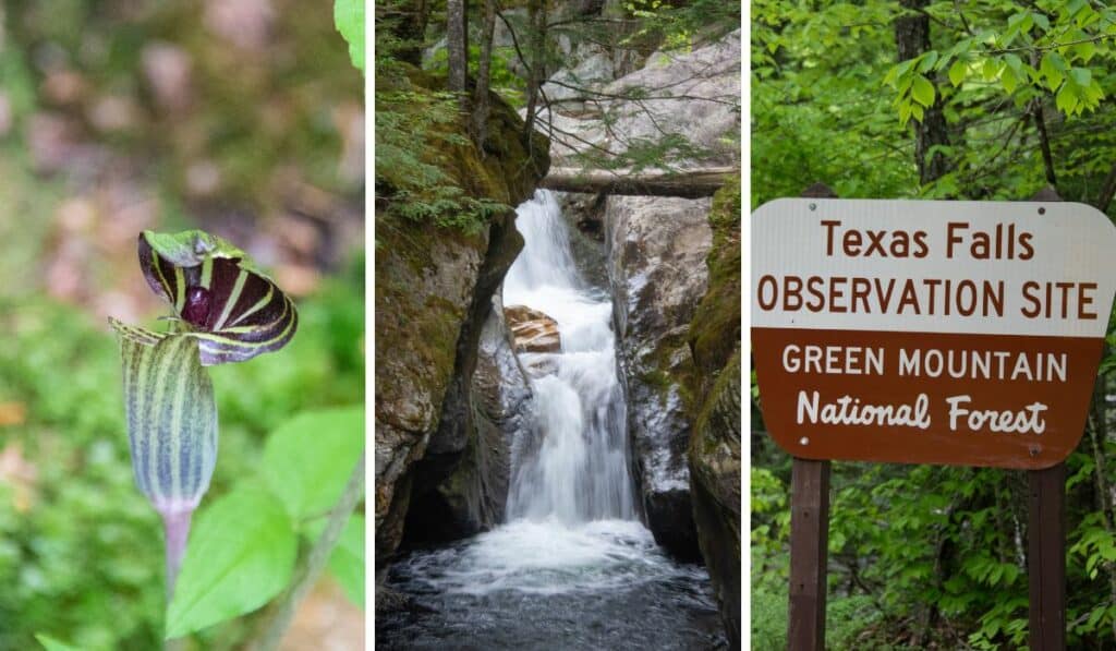
Not only is Texas Falls one of Vermont’s most stunning waterfalls, but this lovely area also includes a riverside picnic area and a short, easy nature trail through the woods.
This is one of our favorite stops on a Route 125 day trip through the Green Mountains.
Quick Facts: Texas Falls Nature Trail
Length: 1.2 miles
Difficulty: Easy. The falls can be viewed from the footbridge near the parking area, or you can continue on the loop trail.
Estimated time: 30 minutes
Elevation Range: 1,299 ft. -1,316 ft
Elevation Change: 70 feet
Dogs: Yes, on-leash
Cost: Free
Maps: AllTrails
Directions to Trailhead (Google Maps)
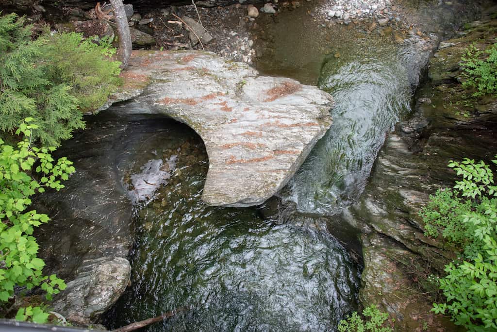
Texas Falls began to form at the close of the ice age, approximately 12,000 years ago, when melting glacier ice began to cut through the glacial till and bedrock.
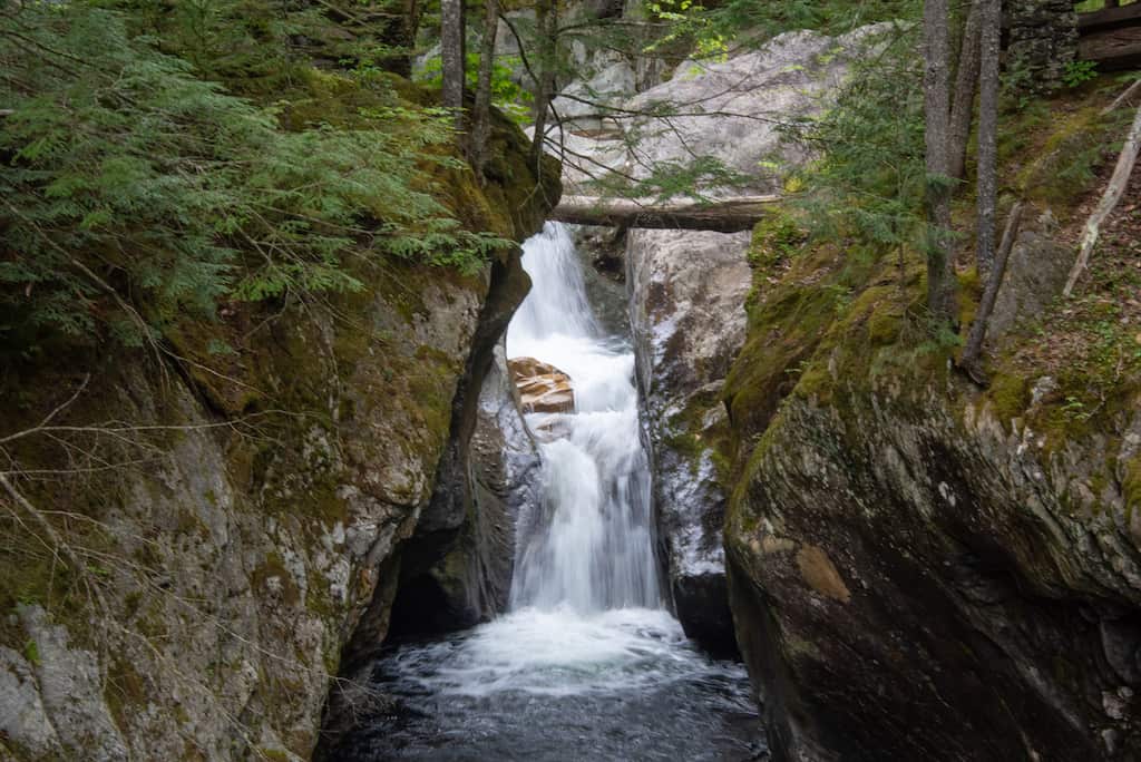
During the thousands of years that followed, high volumes of water enlarged weak points in the bedrock. These points were further enlarged and smoothed by the swirling of rocks and debris to form the potholes that are now visible along the river. A footbridge crosses what remains of a large glacial pothole.
Texas Falls is located on the Hancock Branch, which drains east into the White River and eventually into the Connecticut River. The falls are actually a series of plunges flowing through a narrow, steep gorge.
A visit to Texas Falls makes a great Vermont day trip or picnic outing, and if you’re driving Route 100, they’re just a short detour from the town of Rochester.
The falls are easy to view from the footbridge, as well as several viewing areas along the river.
Swimming is not permitted near the falls for safety reasons, but there are spots for wading near the picnic area, which is located upstream.
Written Directions to Texas Falls in Hancock
Route 125 between Route 100 and Route 7 travels through a scenic part of Vermont’s Green Mountain National Forest.
From Rochester, travel north on Route 100 and turn left on Route 125. In 3.1 miles, turn right onto Forest Road 39. From Middlebury, travel south on Route 7 and turn left on Route 125. In 9.8 miles, turn left onto Forest Road 39. Parking is located at the Falls Observation Site at 0.5 miles and at the picnic area at 0.7 miles.
Featured Read: AMC’s Best Day Hikes in Vermont
Written by Tara Schatz and Jen Lamphere Roberts, this fully revised guide includes classic hikes such as Camel’s Hump, Mount Mansfield, and sections of the Long and Appalachian trails, along with new additions Raven Ridge, Killington Peak, Moose Bog, and more.
Whether you’re looking for an exploration of nature or to bag a 4,000-footer, AMC’s Best Day Hikes in Vermont is indispensable.
Read Next: Highlights of the Green Mountain National Forest in Vermont
Walking the Texas Falls Nature Trail
The Texas Falls Nature Trail is an easy hike through a mature forest.
We often bring elderly relatives here for a walk, followed by a picnic. The elevation gain is minimal, but there are spots where you have to watch your footing.
For an even easier walk in the area, visit the Robert Frost Interpretive Trail in Ripton (7 miles west), which is a universally accessible loop suitable for those with mobility impairments.
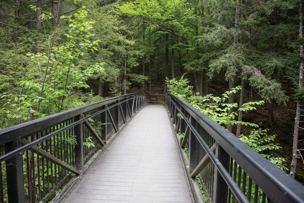
From the parking area on the left side of Forest Road 39, cross over the road and walk back along the road for a short distance to the footbridge. This is an excellent viewing area to view the largest of the waterfalls.
If you just want to view Texas Falls, you can easily see them from this spot and some of the viewing areas along the river for different vantage points. Viewing the falls will take all of five minutes.
If you want to stretch your legs a bit, take the loop trail into the woods, which is marked by blue blazes.
Turn left, following signs for the nature trail.
This is a mixed forest with lots of beech, cherry, and birch trees, with a few interspersed hemlocks. Ferns, hobblebush, winterberry, and spring wildflowers carpet the forest floor.
A wide, well-trodden trail follows the stream for a bit before turning right and entering deeper into the woods and onto a low ridge that runs parallel to the forest road.
A spur trail to the left leads to the picnic area. Continue around the right, leaving the stream behind.
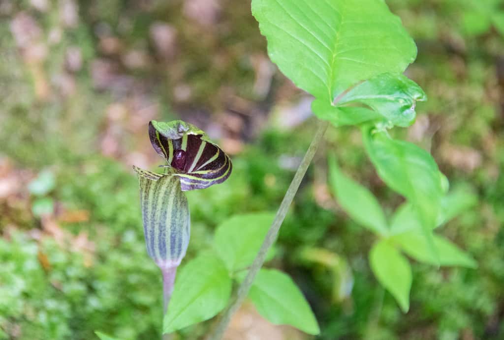
The trail narrows and climbs gently. If you are visiting in spring or early summer, look for numerous jack-in-the-pulpit plants with their three leaves and hooded flowers. Cross several bog bridges, which will keep your feet dry over muddy spots in the trail.
As you wrap your way around the loop, the trail will descend gently. It’s very quiet, with the distant falls and birdsong the only sounds you’re likely to hear.
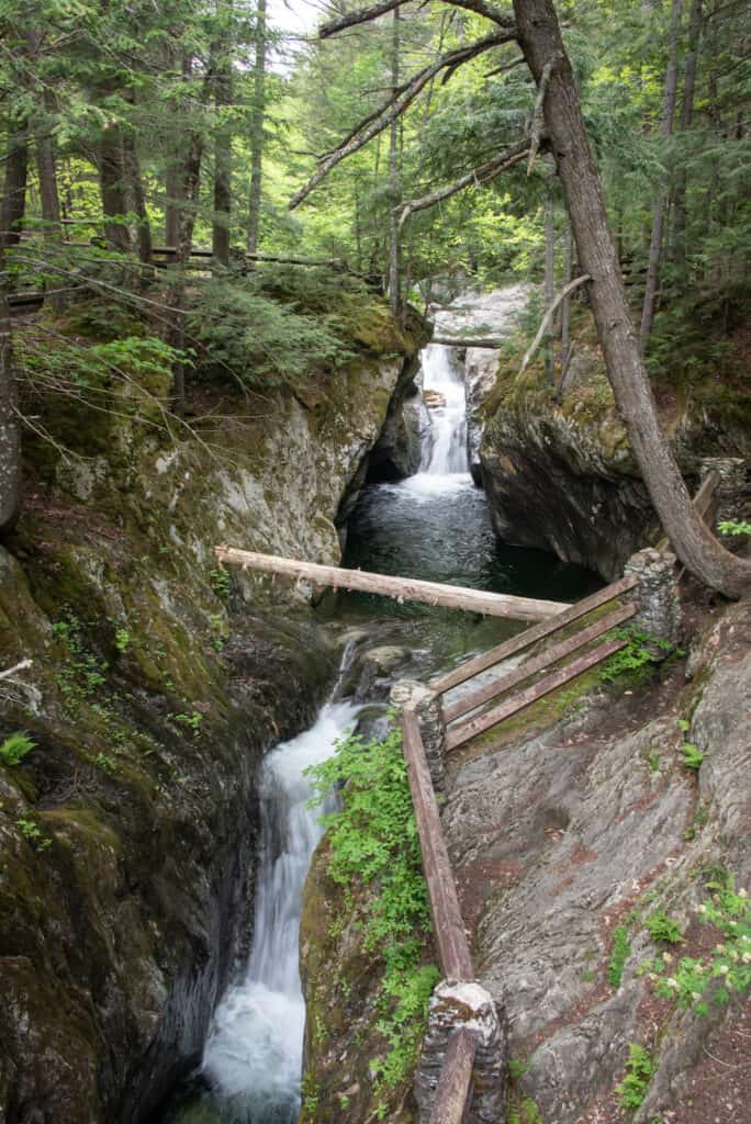
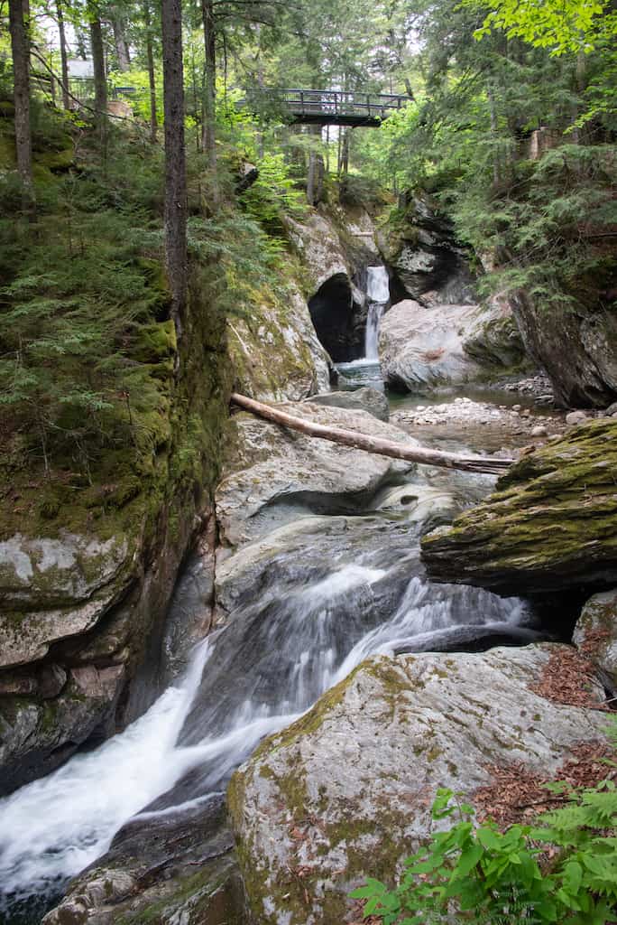
Cross a few small footbridges before popping out, once again, near Texas Falls. A spur trail descends below the falls for another vantage point of the glacial potholes in the river.
Make your way back to the footbridge and the parking area.
Insider tip: Vermont is notorious for its spotty cell service, and GPS isn’t always reliable. We recommend purchasing a copy of the Delorme New Hampshire/Vermont Atlas & Gazetteer. This awesome atlas includes every road and trail in Vermont and is indispensable for exploring Vermont’s back roads and best-kept secrets!
Follow us on social media for more Vermont inspiration!