Hike the Stowe Pinnacle Trail to a Rocky Knob with Dramatic Views
Note: Advertising is how we keep this site free for you to enjoy, and we earn a commission from affiliate links that may be included in this post. Thank you for supporting Vermont Explored!
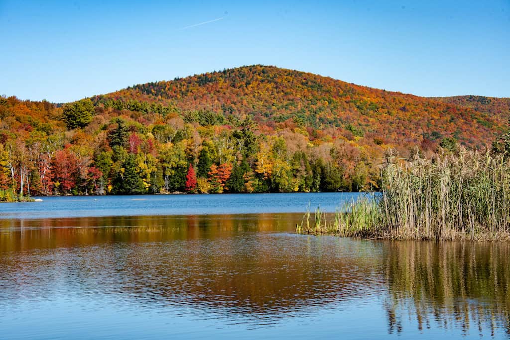
Mountain towns in Vermont aren’t hard to come by, and for outdoor lovers and hikers, Stowe, in the northern Green Mountains, is hard to beat.
Stowe Pinnacle (2,610 feet) is a dramatic rocky knob on the side of the Worcester Range above Stowe, and this moderate hike provides dramatic close-up views of Mount Mansfield and far-reaching views of the Green Mountains.
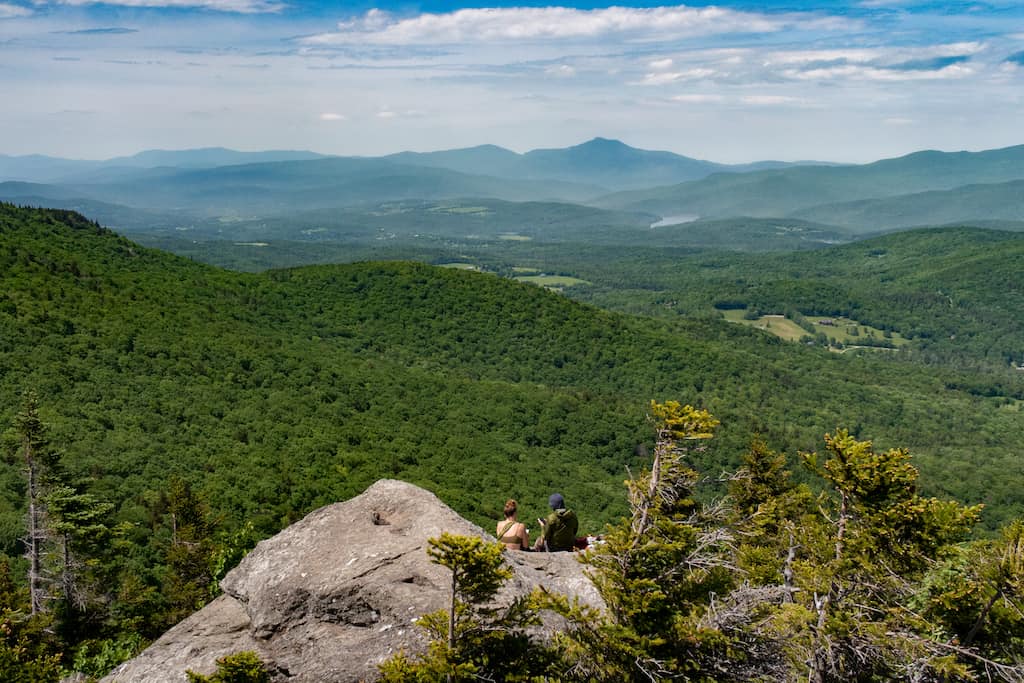
While the steep trek up to Stowe Pinnacle isn’t easy, the 360-degree views make it well worth the effort.
The hike to Stowe Pinnacle is 2.8 miles round-trip, and it’s a steady climb to the top. This busy trail is best enjoyed in the early morning or during the week.
Note: The state closes trails in the Worcester Range between mid-April and Memorial Day to minimize erosion in higher elevations.
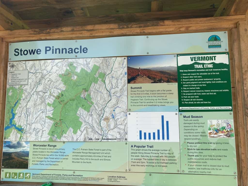
Quick Facts: Stowe Pinnacle Trail in Stowe, VT
Length: 2.8 miles, round trip
Difficulty: Moderately challenging
Estimated time: 2.5 hours
Elevation Gain: 1,520 feet
Dogs: Yes
Cost: Free
Maps: Trail Finder, AllTrails (the linked map shows the out-and-back route)
Getting there: Google Maps
Because the hike to Stowe Pinnacle is pretty short, with wide open skies at the top, it makes a great sunrise or sunset hike. It’s also a fantastic spot for an afternoon picnic. This hike, plus lots more of my favorites, are featured in AMC’s Best Day Hikes in Vermont.

Featured Read: AMC’s Best Day Hikes in Vermont
Written by Tara Schatz and Jen Lamphere Roberts, this fully revised guide includes classic hikes such as Camel’s Hump, Mount Mansfield, and sections of the Long and Appalachian trails, along with new additions Raven Ridge, Killington Peak, Moose Bog, and more.
Whether you’re looking for an exploration of nature or to bag a 4,000-footer, AMC’s Best Day Hikes in Vermont is indispensable.
Also Read: Best Hiking in Stowe VT: Easy to Moderate Trails
Hiking the Stowe Pinnacle Trail: The Details
There are two ways to hike to Stowe Pinnacle. This guide describes the hike from the Stowe Pinnacle Trailhead. If the parking lot is full, or if you want to try something different, you can hike the Pinnacle Meadow Trail, which is 3.2 miles round trip and not quite as steep.
Stowe Pinnacle Trail begins off of Upper Hollow Road. The parking lot is small, with room for about nine cars, so I recommend getting to the trailhead before 8 am on the weekends and before 9 am during the week.
From the parking area, proceed through an overgrown field before entering the woods. Blue blazes mark the route as it gently ascends over bog bridges and large stepping stones. The trail enters a dark woodland of maples, white pines, and paper birches.
At the point where the climb becomes more sustained, an overgrown rock cairn, continuously built by hikers over the years, sprawls in the middle of the trail.
From this point, the trail takes the most direct route up a steep, wooded ridge between two stream valleys. A rock staircase provides a relatively flat tread on what would otherwise be an uncomfortably steep route. The stairs also help prevent erosion from run-off and the thousands of footsteps that tread this path each year.
At the one-mile mark, catch your breath in a clearing where Stowe Pinnacle Trail meats Pinnacle Meadow Trail. Continue to climb the rock steps out of the clearing and follow the blue blazes for Stowe Pinnacle Trail to the right.

More climbing and flight after flight of rock steps finally lead to a small ridge between two steep slopes. A spur path heads up the left slope to a view of the ridgeline between 4,083-foot Camel’s Hump and 4,393-foot Mount Mansfield and of the farm fields and rolling hills of Stowe.
Follow Stowe Pinnacle Trail straight ahead, curving through beech, hobblebush, and striped maple as it circles behind Stowe Pinnacle.
A hard right brings you into a forest of fragrant balsam fir. Climb the wide wooden ladders and bypass the junction with Hogback Trail on the left as you exit the woods onto the bald rocky summit of Stowe Pinnacle.
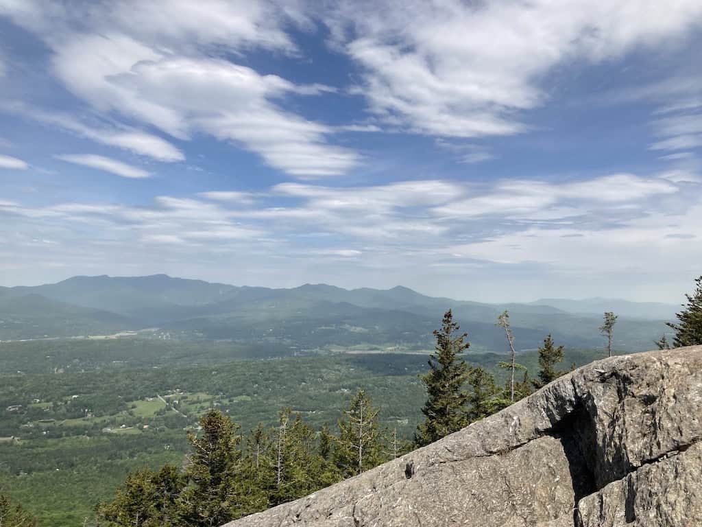
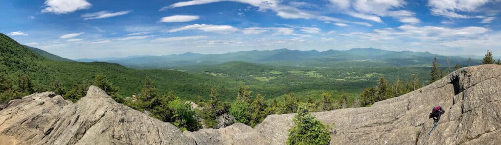
The long ridge of mountains viewed from the summit include, from south to north, Monroe Skyline, Camel’s Hump, Bolton Mountain, Mount Mansfield, Whiteface Mountain, and Belvidere Mountain, as well as Jay Peak on the Canadian border.
To the east, the steep ridge of the Worcester Range continues for 108 miles between the Lamoille River in the north and the Winooski River in the south.
The Worcester Range’s large tracts of red spruce and balsam fir subalpine forest support the inconspicuous spruce grouse, the elusive Bicknell’s thrush, and one of the boreal forest’s savviest hunters, the fisher.
Retrace your steps and return to your car the way you hiked up.
Tips for Enjoying Your Hike to Stowe Pinnacle

This hike is not difficult, but it’s it’s a sustained climb on rock steps that may be slippery when wet. You’ll find yourself looking down a lot to get your footing right. Here are a few tips for hiking the Stowe Pinnacle Trail.
- This trail is closed during mud season. Stowe Pinnacle trail is best hiked between Memorial Day and mid-October, and you may need Microspikes in October for better traction. Winter hiking is recommended only for experienced hikers.
- Hike to Stowe Pinnacle on weekdays and start early. This is one of the most popular trails in the region. To avoid crowds, plan to start your trek early (7 am) or hike during the work week. It’s especially busy in early to mid-October during the fall foliage season.
- Use AllTrails+ to download your maps for offline use. Cell service is spotty up here, so if you’re using AllTrails for navigation, be sure to download your map before heading out. AllTrails+ is $35.99 per year and well worth the cost.
- Use trekking poles. When navigating steep trails like Stowe Pinnacle Trail, I highly recommend using trekking poles to help you maintain stability and balance while reducing the load on your knees.
- Pack the ten essentials. Here’s an overview of the items you should bring with you on every hike. It’s often windy up here, so be sure to pack layers!
- Pack out your trash. Like most of the trails in the Green Mountains, this route doesn’t have trash disposal, so remember that anything you bring up will have to come back down with you. Want to be a good trail ambassador? Bring a small garbage bag to clean up trash left by less thoughtful hikers.
- Be careful going down! Although it feels like going up is the real challenge, going down the steep rocky part of the hike can be just as strenuous, and a fall on those steps would be a fast way to ruin your hike.
- Pack plenty of water. The steps are a killer workout and I’ve found that the best way to conquer them is by going slow and drinking often. Expect to finish a whole bottle on the way up; I finished my first one before the one-mile mark.
- Bring bug spray! Hiking without bug spray in the summer is another great way to ruin a hike. Black flies love this area in June and early July, and then the mosquitoes come out!
Where to Next?

Stowe is a popular tourist town in every season, and there are lots of cool things to do nearby. Here are a few ideas for what to pair with your hike to Sterling Pond.
- Visit Stowe Village for shopping, dining, and ice cream!
- Visit Gold Brook Covered Bridge: Built in 1840, Gold Brook Covered Bridge is tucked away in the foliage on Covered Bridge Road, not far from the Stowe Pinnacle trailhead. This is one of the most photographed spots in Stowe and is said to be haunted by a young woman named Emily, which is why most people call it Emily’s Bridge.
- Hike more trails: Here are some easy/moderate trails in and around Stowe.
- Spend the weekend: We love Tälta Lodge for its low-key, cozy vibes and lovely views of the river.
- Drive to the top of Mount Mansfield. A long ridge connects Mount Mansfield’s various body parts — the nose (4,062 feet), upper lip, chin (4,393 feet), and Adam’s apple (4,060 feet). You can drive right up to the nose on the Auto Toll Road from Stowe Mountain Resort. This 4.5-mile road starts at 3,850 feet and is open from late May to late October ($32 for car and driver. $12 for additional passengers).
Read Next: 18 Delightful Things to Do in Stowe in Every Season
Follow us on social media!


Tara Schatz is a freelance writer and the founder and editor-in-chief of Vermont Explored and Back Road Ramblers, an American road trip blog. She is also the co-author of the 3rd edition of AMC’s Best Day Hikes in Vermont, released in May 2023, and the author of 100+ Wonderful Ways to Experience Vermont.